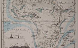
J. H. Colton takes a turn at the trendy "physical" map in the middle of the 19th century - this one dated 1860, and showing in great and accurate detail temperatures and currents at sea, and rivers and mountains on land. A very strong and instructive map with latitude readings and fine mountain profiles toward the bottom of the map.
There are mentions on the map of commodities found in the heart of Africa, such as gold (dust), Ivory, feathers, salt, and copper.