Image ID: 364
Pointe Venus at the northern portion of Mavavia Bay, where the transit of Venus was observed on June 3-4, 1769. This completed the 1st portion of Cook's mission. Secret orders were then opened which instructed Cook further south in search of the theoretical southern continent Australis Incognito.
Dots OFF
Dots ON


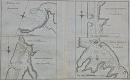
Matavia Bay Otaheite
Cook Tahiti 2