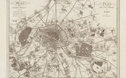
Plan de la ville de Paris avec ses environs (1805) Austrian engarver Johann Spiegl created this map during the reign of Emperor Napoleon I. Clear detail of Paris, its fortifications, city walls and nearby woods. Note the École militaire is now within the walls of the city whereas it resided outside in the 1705 map. Relief shown by hachures, titles in German and French with place names in French. / Image courtesy of Library of Congress, Geography and Map Division.