HUMN 4030 - Art of Travel - University of Colorado
Image ID: 1125
Image ID: 1127
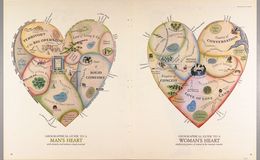
Two allegorical maps of romance, dense with contemporary stereotypical references. The Man's Heart, for example, is bordered by the Don't Fence Me In Fence and Impenetrable Wall of Ego, while the Woman's heart features the State of Security adjoining Love of Love Land.
Maps can be metaphorical; they can depict an imagined place or, in this case, a map of thoughts or emotions.
What is your favorite place on this map?
Image ID: 1129
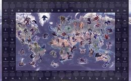
The Mythical Monster Map was created by Peter Dobbin, a renowned UK artist. The monster images portrayed on this map of the world bring life to myths and legends from many countries and cultures.The map shows 61 creatures and includes their country of origin and a description of their characteristics.
Look around. Are you familiar with any of these monsters? Which is the scariest to you?
Image ID: 1128
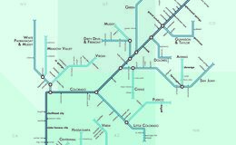
This map shows the Colorado River and its tributaries in a unique way -- as a subway map. Is this map understandable to you? Does its method of conveying information make sense or is it confusing?
Image ID: 1126
Best compass rose design ever!
Image ID: 1122
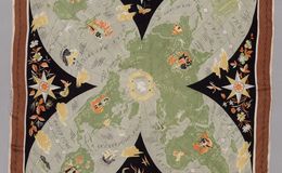
Maps can be made on a myriad of different materials. This one is made on silk. Get creative with material types when working on your final project!
Add whimsical features to your map. Here you see clouds, flowers, a sea monster, and some very artistic compass roses.
Image ID: 1123
Have you heard of these legends or figures in folklore? Keep in mind the date of this map.
Image ID: 1268
This map has a dark half and a light half with the moon and its rainbows right in the center. Why might the moon be central to a map of myth and fantasy?
Would you rather explore the path through the dark half or the light half?
Here's an example of a SCALE based on a unit that is not a measure of distance. And, a COMPASS ROSE with directions in fantastical dimensions.
Image ID: 1266
This map was made by asking community members to add things to the map that are important to tell the full story of the region's cultures. You could get input to your map project from important people in your life!
Check out this decorative border, with such a variety of images important to the overall story of the map.
Image ID: 1269
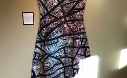
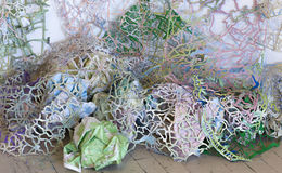
The artist chose to make this quilt called "Lost...or Found?" in the shape of a dress, rather than a traditional rectangle or square. What do you think the dress has to do with the theme "Lost...or Found?" and maps?
The artist dyes and paints her own fabrics before constructing her quilts. If you like working with textiles or sewing, perhaps this medium would work for your final project!
Image ID: 1270
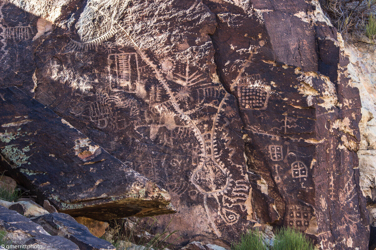
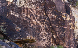
The most unique rock art at the Gap is what is known as the “zipper glyph.” While the other rock art in the Gap isn’t necessarily one-of-a-kind, there is nothing like the zipper glyph seen anywhere else.
And it is a prime example of the differences in interpretation of the Gap petroglyphs. In the astroarchaeological perspective, the zipper is a map of the site, showing how the solstices and equinoxes align with it.
However, according to the Paiute Tribe, the glyph is about a man’s journey and a few other events, such as people starving.
From St. George News
What symbols will you use in your map? Will they be personalized to you or will they be standard map symbols? Will you include a key (legend) or will you let the symbols speak for themselves?
Image ID: 1271
When these road networks are cut from maps, they resemble other networks, such as blood vessels, neurons, internet connections...what other features could you cut from maps to add layers of meaning to your project?
We wish you could come to the map library and choose free maps for your craft projects! If you want some, we can arrange to put some in contactless pickup for you.
Image ID: 1272
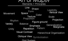
Important map-making elements and principles on this side. But you can consider all these things when you make your map!
Image ID: 792
Image ID: 744
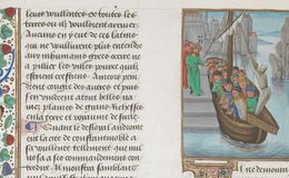
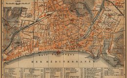
Pilgrim ship arrives in Damietta Egypt, after crossing the Mediterranean. Where do you think the pilgrims were coming from?Google map location of Damietta
This image is from a 1480 manuscript about the history of the Crusades, based on the 12c work of William of Tyre: Historia rerum in partibus transmarinis gestarum ("History of Deeds Done Beyond the Sea"). What do you think the "deeds" are and why would readers of this manuscript want to learn about them? See entire manuscript and description here.
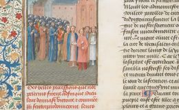
Image ID: 745
Image ID: 743
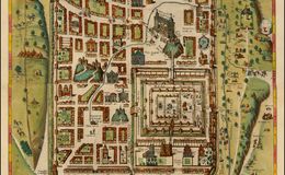
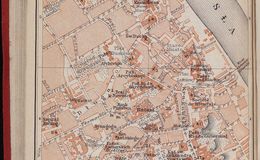
This map shows Jerusalem at the time of Jesus Christ, and also contains historical and Biblical scenes alongside buildings and figures from the 16th century.
Why might the cartographer have chosen to mix these all together?
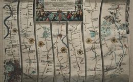
Image ID: 741
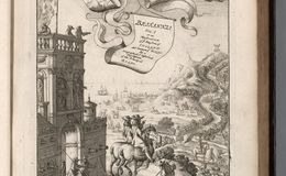
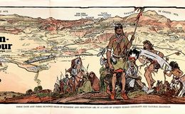
This is the frontispiece from the first "road atlas" ever published. It covers much of England. What things do you notice about the people (and putti!) in this image?
Image ID: 742
Image ID: 649
Image ID: 642
Image ID: 644
Image ID: 645
Image ID: 640
Image ID: 641
Image ID: 650
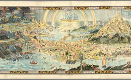
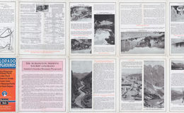
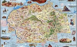
What story of this region is told by the text on this map (History, Legend and other texts)?
Image ID: 648
Image ID: 646
Image ID: 647
Image ID: 643
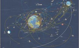
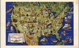
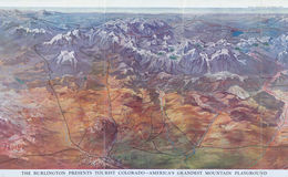
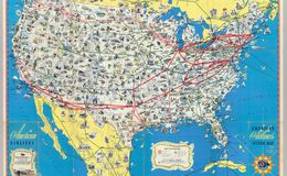
This map is designed to show a lot of activity in space exploration. How does the idea of
the "Conquest of Space" strike you now, in 2020? Are we closer to or further from Conquest?


.jpg)