1911 Baker Map & Art Collection
Image ID: 5862
5862
Image ID: 6069
6069
Image ID: 5861
5861
Image ID: 6064
6064
Image ID: 6065
6065
Image ID: 6071
6071
Image ID: 6073
6073
Image ID: 6063
6063
Image ID: 6070
6070
Image ID: 6061
6061
Image ID: 6067
6067
Image ID: 5863
5863
Image ID: 5865
5865
Image ID: 5866
5866
Image ID: 6058
6058
Image ID: 6059
6059
Image ID: 6068
6068
Image ID: 6066
6066
Image ID: 6072
6072
Image ID: 5744
5744
Image ID: 5849
5849
Image ID: 5742
5742
Image ID: 6060
6060
Image ID: 5743
5743
Image ID: 5850
5850
Image ID: 5746
5746
Image ID: 5859
5859
Image ID: 5855
5855
Image ID: 5856
5856
Image ID: 5860
5860
Image ID: 5858
5858
Image ID: 5851
5851
Image ID: 5852
5852
Image ID: 5853
5853
Image ID: 5854
5854
Image ID: 5857
5857
Image ID: 6209
6209
Dots OFF
Dots ON


E205 - Jann Pollard 1995 - PH1453 - M5862
E205 - Jann Pollard - PH1474 - M6069
E205 - Jann Pollard - PH1472 - M5861
E205 - Jann Pollard - PH1464-65 - M6064
E205 - Jann Pollard - PH1466 - M6065
E205 - PH1492-93 - M6071
E205 - PH0012 - M6073

E205 - PH1462-63 - M6063
E205 - PH1490-91 - M6070
E205 - PH1460-61 - M6061
E205 - PH1471-72 - M6067
E205 - PH1454 - M5863
E205 - PH1455 - M5865
E205 - PH1456 - M5866
E205 - PH1457 - M6058
E205 - PH1458 - M6059

E205 - PH1473 - M6068
E205 - PH1467 - M6066
E205 - PH1540 - M6072
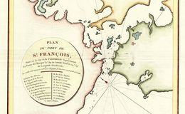
E205 - San Francisco - La Perousse - 1798 - M5744
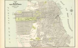
E205 - Cram's San Francisco 1898 - M5849
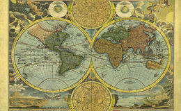
E205 - The World - Martin Waldseemueller - 1513 - M5742
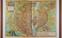
E205 - Paris - Braun & Hogenberg - PH1458 - M6060
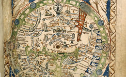
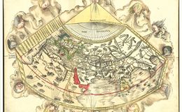
E205 - Psalter Map - 1265 - M5743
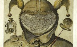
E205 - The World Epichtonius - 1585 - M5850
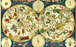
E205 - Celestial Planisphere - Frederick de Wit - 1680 - M5746
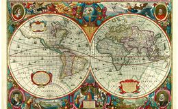
E205 - The World by Hondius - 1630 - M5860
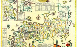
E205 - Japan Kaempfer - 1692 - M5855
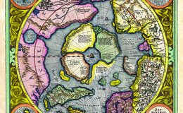
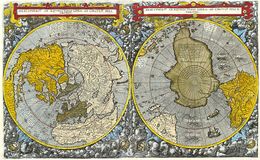
E205 - North Pole Mercator - M5856
E205 - The World - Johann Baptist Homann - 1716 - M5860
E205 - The World - Cornelius de Jode - 1593 - M5858
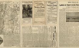
E205 - Northern Pacific Railroad - 1898 - M5851
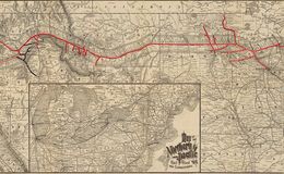
E205 - Northern Pacific Railroad backside - 1898 - M5852
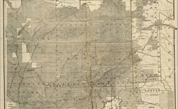
E205 - Northern Railroad Map - 1898 - M5853
E205 - Northern Railroad Map backside - 1898 - M5854
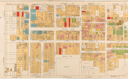
E205 - San Francisco Chinatown, by Board of Supervisors, Farwell, Kunkler & Pond, 1885 - M5858
E205 - PH1700 - M6209