GEOG 3672: Who Runs the World? Sex, Power, and Gender in Geography - University of Colorado
Image ID: 4088
4088
Image ID: 4094
4094
Image ID: 4102
4102
Image ID: 4064
4064
Image ID: 4044
4044
Image ID: 4089
4089
Image ID: 4057
4057
Image ID: 4054
4054
Image ID: 4060
4060
Image ID: 4061
4061
Image ID: 4059
4059
Image ID: 4058
4058
Image ID: 4056
4056
Image ID: 4062
4062
Image ID: 4091
4091
Image ID: 4095
4095
Dots OFF
Dots ON


E141 - GEOG 3672 Discussion questions
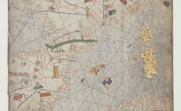
E141 - Catalan Atlas sheet of North Africa, Cresques Abraham 1375

E141 - Algiers from Braun & Hogenberg 1588

E141 - A New and Correct Map of the Coast of Africa 1774

E141 - Africa 1775

E141 - Levaillant map of southern Africa made for Louis XVI (1790)

E141 - A map shewing the progress of, discovery & improvement, in the geography of North Africa, 1798

E141 - Royal Atlas Africa 1878

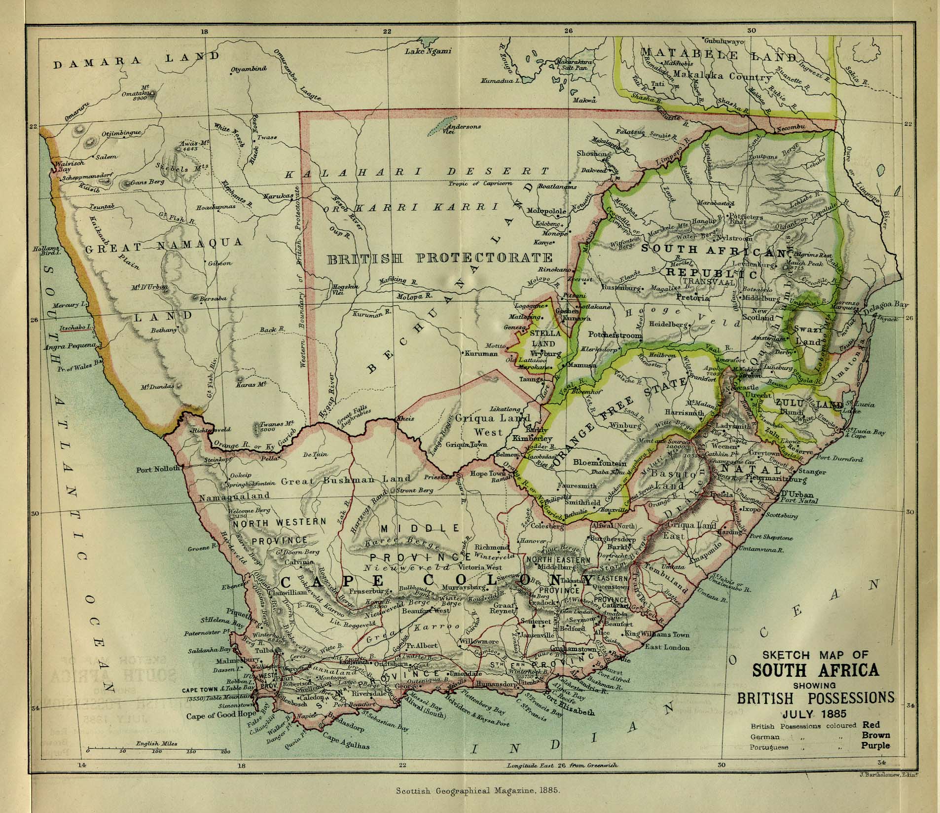
E141 - Sketch Map of South Africa Showing British Possessions 1885

E141 - A Map of the Route of the Emin Pasha Relief Expedition 1890

E141 - Africa Religions & Missions 1913

E141 - East Africa Land of Sunshine 1949

E141 - Energy Map of Africa 1996

E141 - Africa Ethnolinguistic Groups 1996

E141 - Blaeu Atlas Maior frontispiece of Africa volume

E141 - Africae nova descriptio..., Blaeu 1663